Choose the route and its starting point together. A view of Mudeungsan from Gwangju is the beginning of the plan, not a measure of the climb.
Look for the rock formations behind the skyline
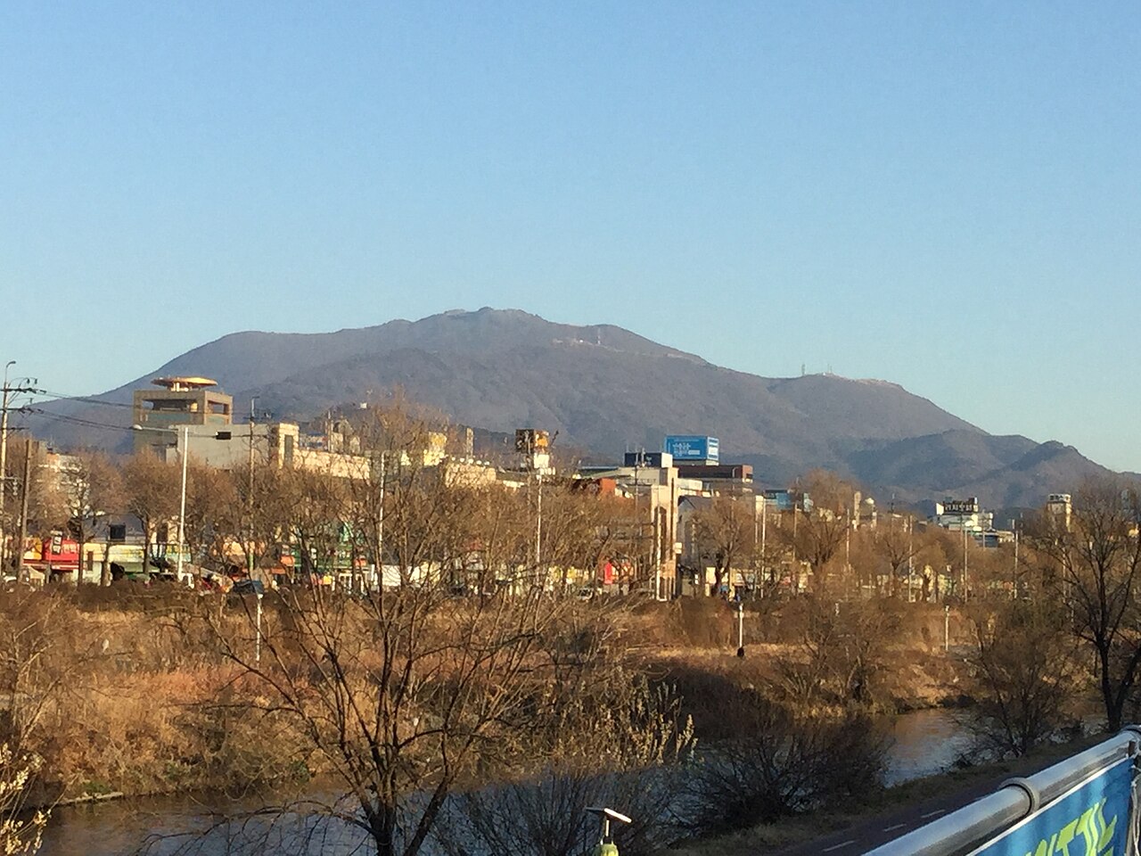
Mudeungsan rises beside Gwangju and extends into the surrounding area. The National Park Service highlights its upright rock formations, including Seoseokdae and Ipseokdae, as well as seasonal vegetation. The mountain's relationship with the city is visible in the photograph: buildings fill the foreground while the ridge forms the skyline.
That distant view does not show the surface or difficulty of an individual trail. Decide whether you want a shorter foothill visit or a mountain walking day before selecting the places to include. A particular rock formation is a route objective, not necessarily a quick stop from the nearest road.
Compare named routes before choosing transport
KNPS lists several different routes, including Saeinbong–Ipseokdae, Neutjae–Old Trail and the Dangsan Tree course. Read the route description, distance and difficulty for the walk you intend to take, then identify its starting point. A route name alone does not establish that it is a loop or ends where you leave your car.
The Google map below identifies the park on the Geumgok-dong/Wonhyosa side. The overview pin is a general park reference. Neither replaces the precise departure point for a chosen trail, and a plan using another approach needs a different final journey.
Plan your visit
| Practical detail | What to know |
|---|---|
| Destination | Mudeungsan National Park, Gwangju and the surrounding Jeolla area. |
| General park location | Geumgok-dong, Buk-gu, Gwangju; choose the exact trail start separately. |
| Park inquiry | +82-62-227-1187. |
| Admission | Park admission is free. Parking and individual services may have separate conditions. |
| Route selection | Compare the official named courses and arrange transport to the selected starting point. |
| Entry and access | Check KNPS trail closures and route-specific entry cutoffs before travelling. |
Leave enough time to come back down
KNPS asks visitors to check both entry-time restrictions and trail-control information. A general park listing that says open all day should not be read as permission to enter any route at any hour. Check the status of your particular route shortly before departure and follow the signs on arrival.
Allow daylight for the return, not just for reaching a viewpoint. Seasonal colours and snowy scenery describe the landscape, not conditions that make a walk suitable for everyone. Choose footwear and clothing for the forecast and the trail, carry what you need for the planned walk, and shorten the route if the conditions or your pace require it.